The Beach at the End of the Trail
July 14, 2014 at 10:51 a.m.
Lewis and Clark traveled more than 4,000 miles searching for a water route that would span the American west. Where did they end up? On a small stretch of sand near Seaside, Oregon, 80 miles west of Portland.
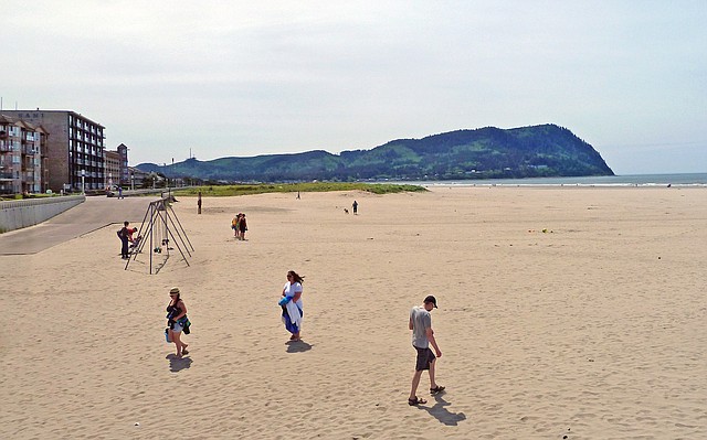
Today Seaside is a popular recreational community, attracting visitors who want surf-perfect waves, abundant tide pools, good hiking and the chance to follow the Lewis and Clark Corps of Discovery during the last days of their journey to the Pacific.
My husband and I walk through town, heading toward a bronze statue that immortalizes the area’s flirt with fame. The streets are filled with people.
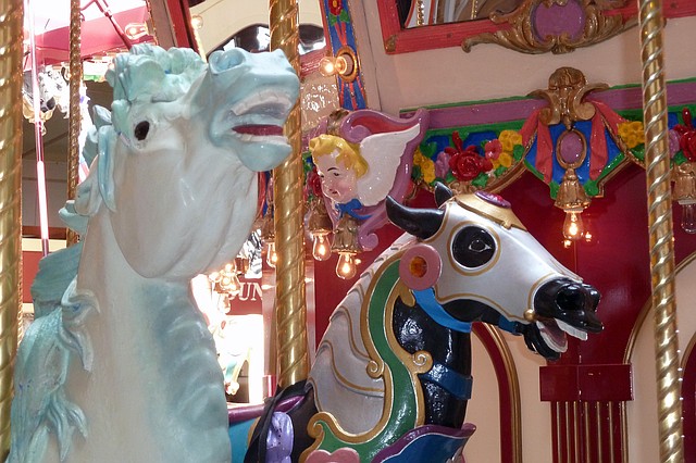
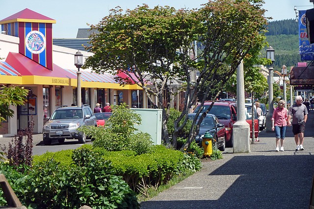
Some are simply strolling, enjoying the sea-fresh air, while others are shopping in an eclectic assortment of stores, many of which are arranged around an old-fashioned merry-go-round in the aptly named Carousel Mall.
Of course, we intersperse our meanderings with food — a fish taco at Firehouse Grill, homemade root beer and ice cream at Flashback’s, and a cup of the clam chowder that Bon Appétit dubbed “one of America’s top ten soups” at Norma’s.
To work off the calories, we go to Wheel Fun Rentals, where we debate whether to rent a surrey (elegant), a tandem bike (easy, especially for me) or a regular bicycle (exercise for both of us). We finally opt for bikes so we can explore areas on the outskirts of town as well as pedal the Promenade, a 1.5-mile concrete path that runs parallel to the sea.
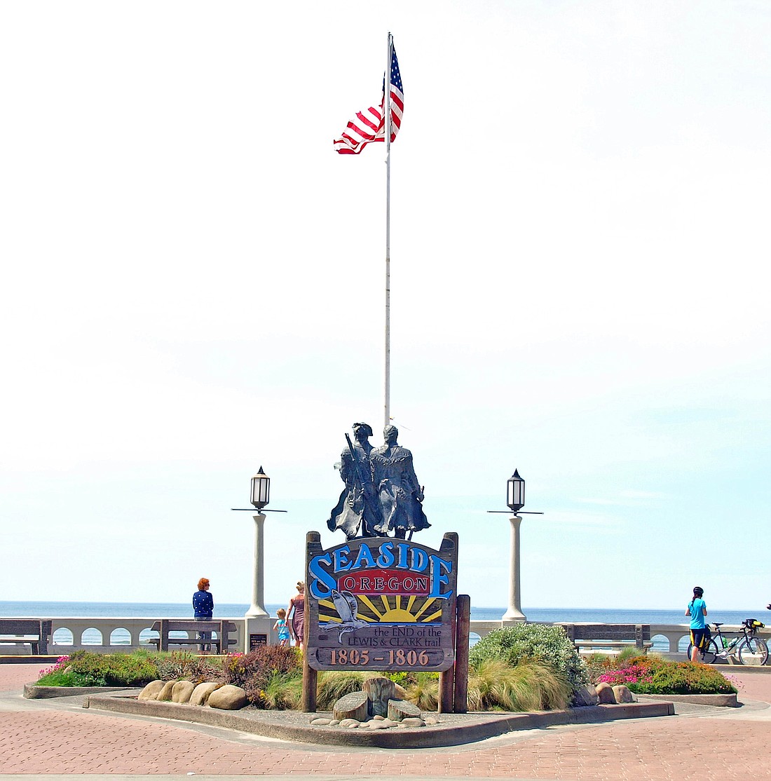
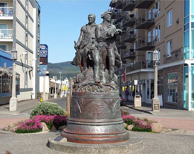
There, at the point where the Prom intersects Broadway, is the statue of the two explorers. It’s larger than life, as befits the men it depicts, and is backed with a sign that reads “the END of the LEWIS & CLARK trail, 1805-1806.”
The next morning we set out to learn why and how Seaside became the last stop of the Lewis and Clark expedition.
We begin at Cape Disappointment, 30 miles northwest of Seaside. “Since this is one of the foggiest places in the country, it’s almost certain that you're having the same weather as did the Lewis and Clark team,” says a ranger. “But they were too elated to worry about the weather; they had finally reached the Pacific Ocean.”
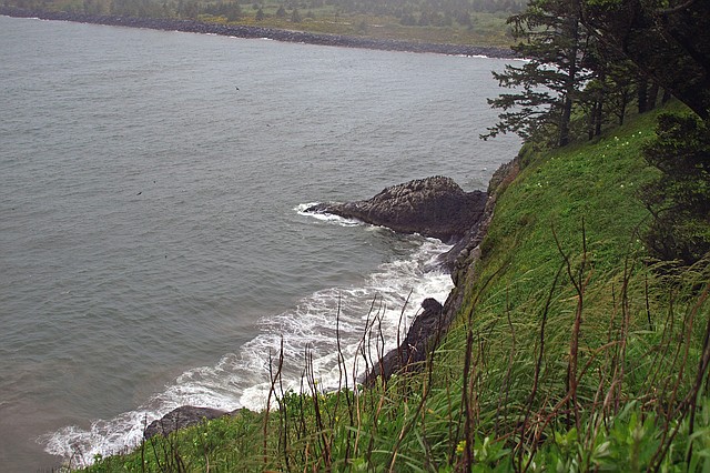
We forego the beachcombing for which the 1,900-acre park is famous, instead spending our time at the interpretive center and hiking a trail that was used by the Corpsmen as they explored the area.
Although the men were eager to return home since they had achieved their goal, many a snow-covered mountain stood between the Pacific Ocean and their starting point in St. Louis. They needed a hunkering place for the winter, and they found a suitable spot on the Oregon side of the Columbia River, midway between the Cape and Seaside.
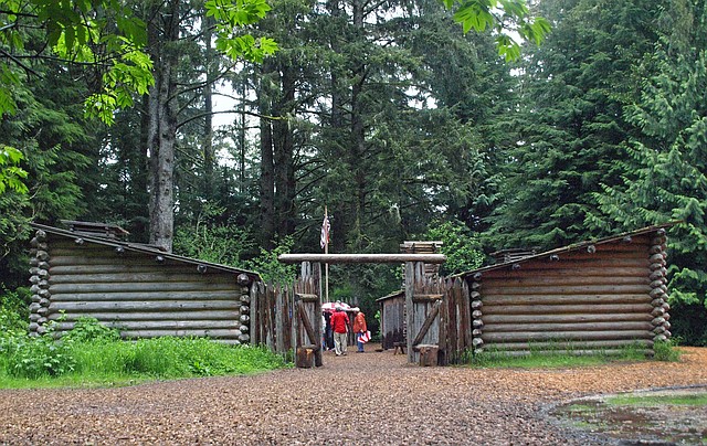
Today that spot, Fort Clatsop, is a National Historical Park that features a full-size replica of the original fort, ranger-led programs, an exhibit area and a bookstore that will please even the most devoted Lewis and Clark fans.
As we walk through the fort, a costumed interpreter explains what life was like during the winter of 1805-06. In short, it was hard. The men were almost out of food, and they spent much of their time hunting elk, deer and small game. On one occasion, hearing that a whale had washed ashore, they hiked over Tillamook Head to the beach in what is now Ecola State Park. To their dismay, by the time they arrived, the Indians had picked the whale clean.
We consider following the explorers’ footsteps until we read that Clark called Tillamook Head “the steepest, worst & highest mountain I ever ascended.” Figuring that he was undoubtedly in better shape that we are, we hop in the car for a 15-minute drive to Ecola. From there it’s a comparatively easy trek to the beached whale site.
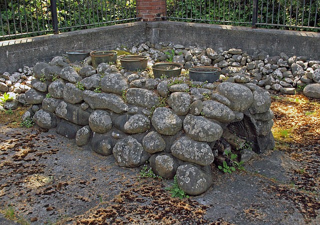
But the men not only had to get food, they also had to preserve it; and to do that, they had to extract salt from the ocean. Therefore, five Corpsmen established a small outpost on a nearby beach. They made ovens from rocks, found branches for fuel, and boiled seawater for two months, collecting enough preservative to safeguard their food for the rest of their trip.
A month later the Corps headed east, and the abandoned salt works thus became the Expedition’s westernmost campsite. Today the reconstructed site is just a few blocks from the statue that proclaims Seaside as the end of the Lewis and Clark trail.
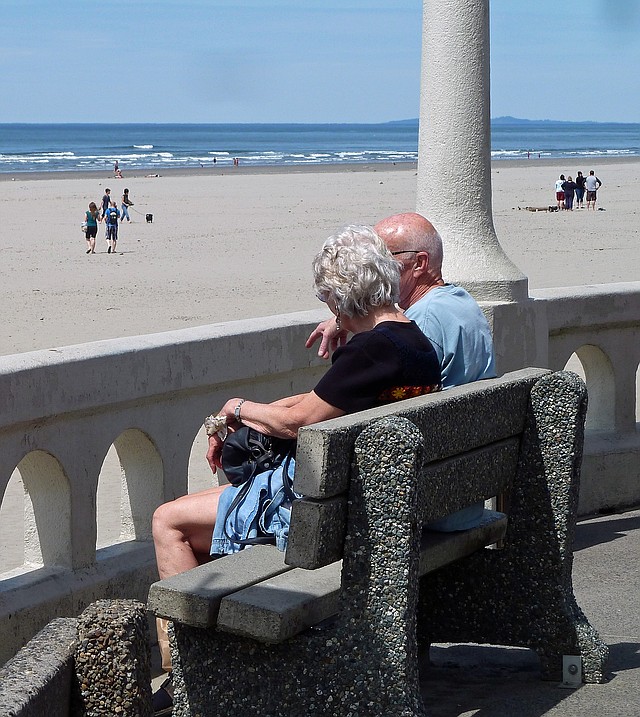
We sit on the Prom, the ocean in front of us, the statue behind us. While I suspect Lewis and Clark were happy to return home, they couldn’t have found a more beautiful place to end their journey.
As for us, we’d like to stay forever.
This article is courtesy www.traveltizers.com
Latest Stories

Embrace the Cauliflower Craze for a Healthier You
Step aside kale, cauliflower is taking the spotlight as the ultimate health superstar
READ MORE...
Ways to Make Gardening Easier as You Age
"I love to putter around and work in the garden, but my back and knees have caused me to curtail my gardening activities"
READ MORE...
Healthy Travel Tips for Older Travelers
We’ve been looking forward to traveling again after staying home the past few years, but my husband has a heart condition and some back problems that worry me
READ MORE...
What to Do About Medicare and Social Security When You Move
If you’re on Social Security and Medicare, you definitely need to let these Federal agencies know when and where you move so there are no hiccups in your benefits or coverage
READ MORE...